 |
Lee Zebold is a local businessman, Mt. Lowe fan, and a Forest Service Volunteer. |
|
Quest For The
Incline
By Lee Zebold
|
Lee Zebold is a local businessman, Mt. Lowe fan, and a Forest Service Volunteer. |
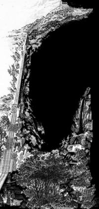
We hiked up the "right of way" right off where Maiden Lane and Rubio Dr. Intersect. I was disappointed when after about 1/4 of a mile our path was blocked off by the development of some new houses under construction. Since we didn't know at the time of the right of way trail that hits Rubio Vista Road, and after some fence jumping, we made our way up the no trespassing road where Camp Huntington used to be. Almost immediately we scrambled down into the creek so as not to be trespassing on anyone's private property.
The whole idea of going up there was to find the old incline and maybe climb it to the top of Echo Mountain. Occasionally we would stop at certain points, and compare them to the pictures we'd find in the book. We saw almost identical views from where we stood when comparing the same shot form a camera taken back in the early 1900's. It really was a thrill.
In all my life, even as a Boy Scout, I had never seen the incline from the bottom. Only from the top looking down. We eventually passed the spot where the pavilion had once been, not realizing that it had been built on stilts. We went to the waterfall before realizing we had passed the spot. Backtracking paid off for we used the guidelines and maps in the book, which turned out to be a reliable source. When we finally discovered what must have been the base of the Incline, Bill thought he saw a trail, and started to go up it. Timarie and I stayed behind. It wasn't long before he called to us that this was the trail- it had yellow ribbons marking it. So the three of us started going up the switchbacks. The yellow ribbons really helped us stay on the proper path, because the trail is not used much, and is not easily observed.
As we progressed up the mountain, it became obvious that we were on the right path because we would run into old rails and rail ties When we came upon what was left of MacPherson's Bridge it was a wonderment to look at the abutments that had been the base for the bridge structure. I was amazed to be looking at these things, all the while realizing that my whole life I had lived in this area, and never saw this remnant of the old railway. It was almost like finding a new toy under the Christmas Tree.
The occasional yellow ribbons lead us up the trail in good fashion. It was later that we learned that this was the original trail used by the mules taking materials and supplies up to the top of Echo for building the structures. Paul Ayers had called me about going up the following Saturday to work on finding artifacts and the Armature he had found over the side. When I told him about our hike, he explained that he had gone up the day before and marked the trail with the yellow ribbons. He wanted to establish the trail, and by marking it clearly, even the casual, uninformed hiker would be able to follow the proper course. What a coincidence.
We finally got up to Echo. It was a real hike. We were pooped. But what an unforgettable experience.
Send email to Echowebmaster@aaaim.com to report any problems.
Last modified: February 12, 1999
No part of this paper may be
reproduced in any form without written permission from:
Jake Brouwer
All articles and photos were provided by:
Land-Sea Discovery Group
Copyright © 1999